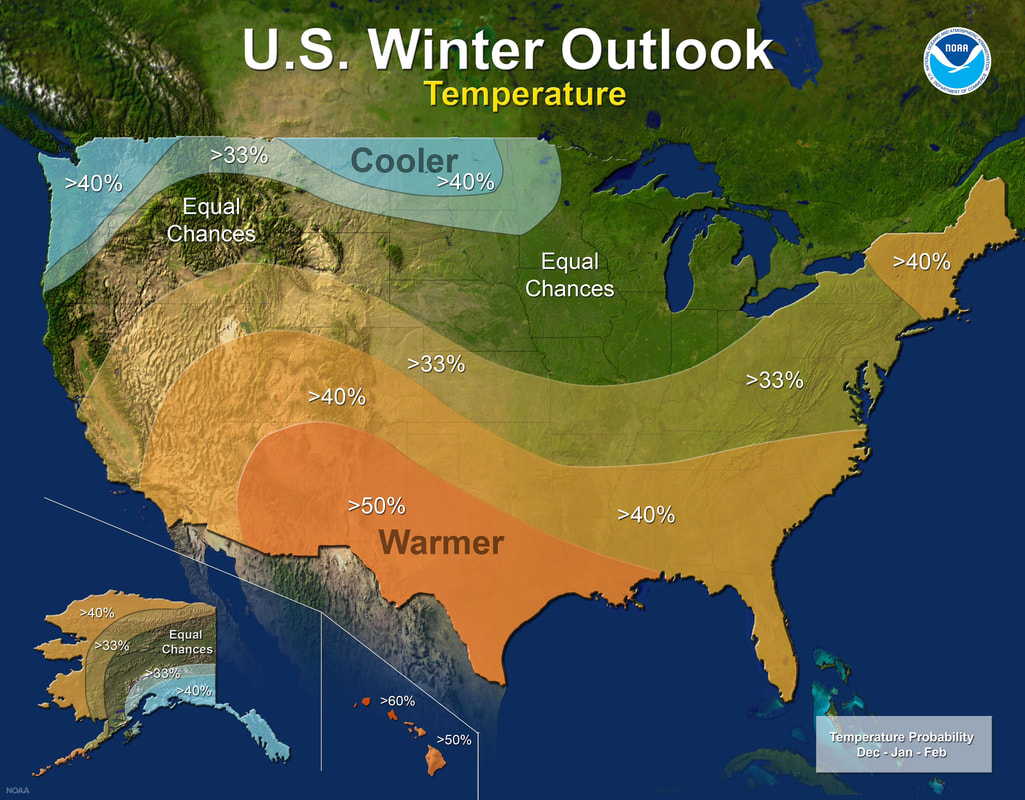
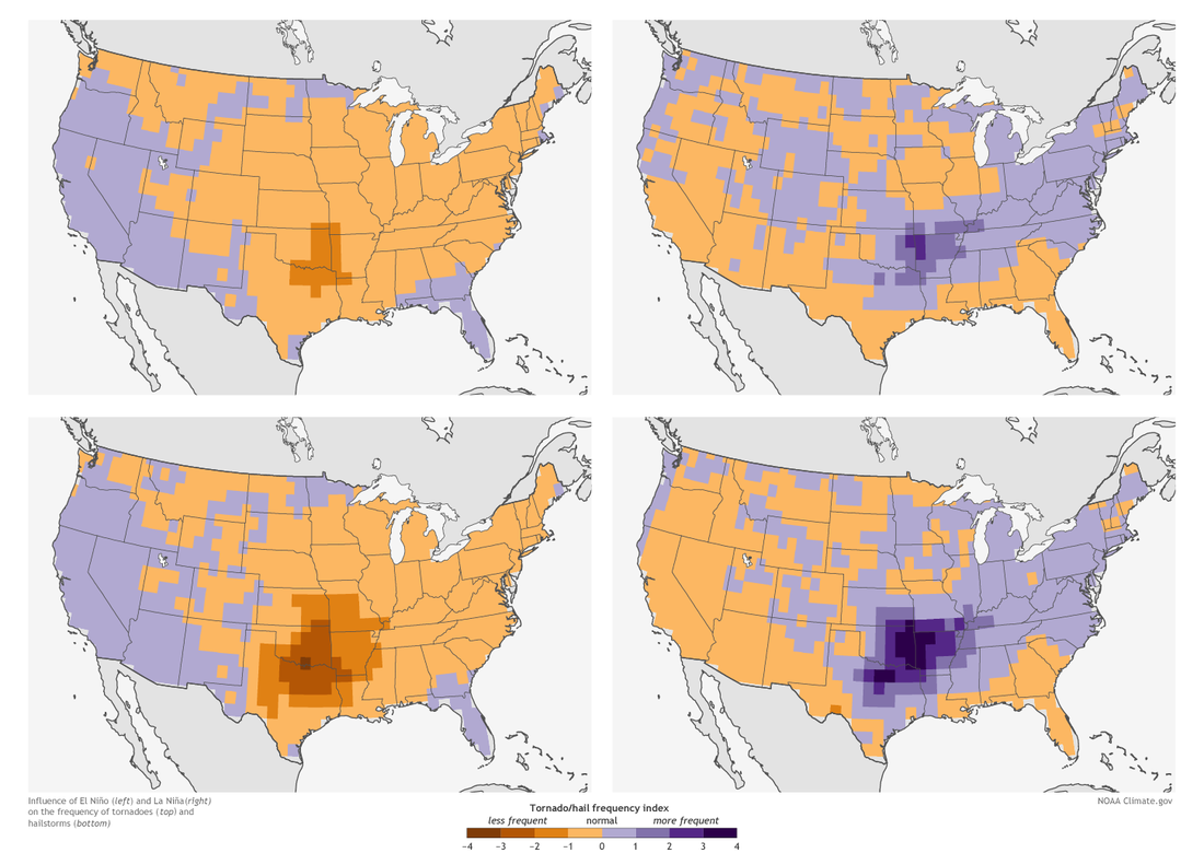
 The National Oceanic and Atmospheric Administration (NOAA) has released its 2017-2018 winter weather predictions, and that might give us a clue about what kind of severe weather we may face next spring when tornado season fires up. NOAA is predicting warmer-than-average winter temperatures for large sections of the United States from California, across the Midwest, and upwards into Maine. The Pacific Northwest and Alaska are predicted to have a colder-than-normal winter, with a skinny strip of average winter weather forming a "belt" across a narrow part of the country. But can winter weather predictions tell us anything about what to expect during the 2018 tornado season? Actually...yes. (This is a great detailed article about how the science works!) That's because NOAA is also predicting a 55% to 65% chance of the development of a La Niña before winter sets in. La Niña weather in the winter causes hot, humid air to concentrate over the southern Plains states. That hot humid air sets up a strong north-south temperature divide that is the catalyst for spring storms as fronts move across the U.S. from the west and encounter the temperature divide. Severe weather like hailstorms and tornadoes were fewer in the spring of 2012 - 2016, years that had El Niño or neutral winters (El Niño is the opposite weather pattern as La Niña patterns). But 2017 was a very active spring with many severe storms and tornadoes that followed a La Niña winter weather pattern. If NOAA's prediction of the development of a La Niña this winter, the data shows that states like Texas, Oklahoma, Arkansas, and Louisiana could be headed for a rough spring. Comments are closed.
|
AuthorMembers of the Safe Sheds team contribute posts from time-to-time. Archives
November 2017
Categories |
We always welcome your visit
1003 South Maple Street
Salem, Illinois 62881 Monday - Friday, 8:00 a.m. - 4:30 p.m. CST 888-556-1531 (toll free) 618-740-0044 (local) [email protected] |
Contact UsSubscribe |


 RSS Feed
